
 By
By 

RCMRD Celebrates 50 Years of Excellence in Geospatial Innovation and Regional Development
The Regional Centre for Mapping of Resources for Development (RCMRD) is celebrating 50 years of transformative service in Africa.
Established in 1975, RCMRD has grown into a continental leader in geospatial science, remote sensing, and sustainable development. It currently serves more than 20 member states across Eastern and Southern Africa. This golden jubilee marks five decades of innovation, training, and collaboration.
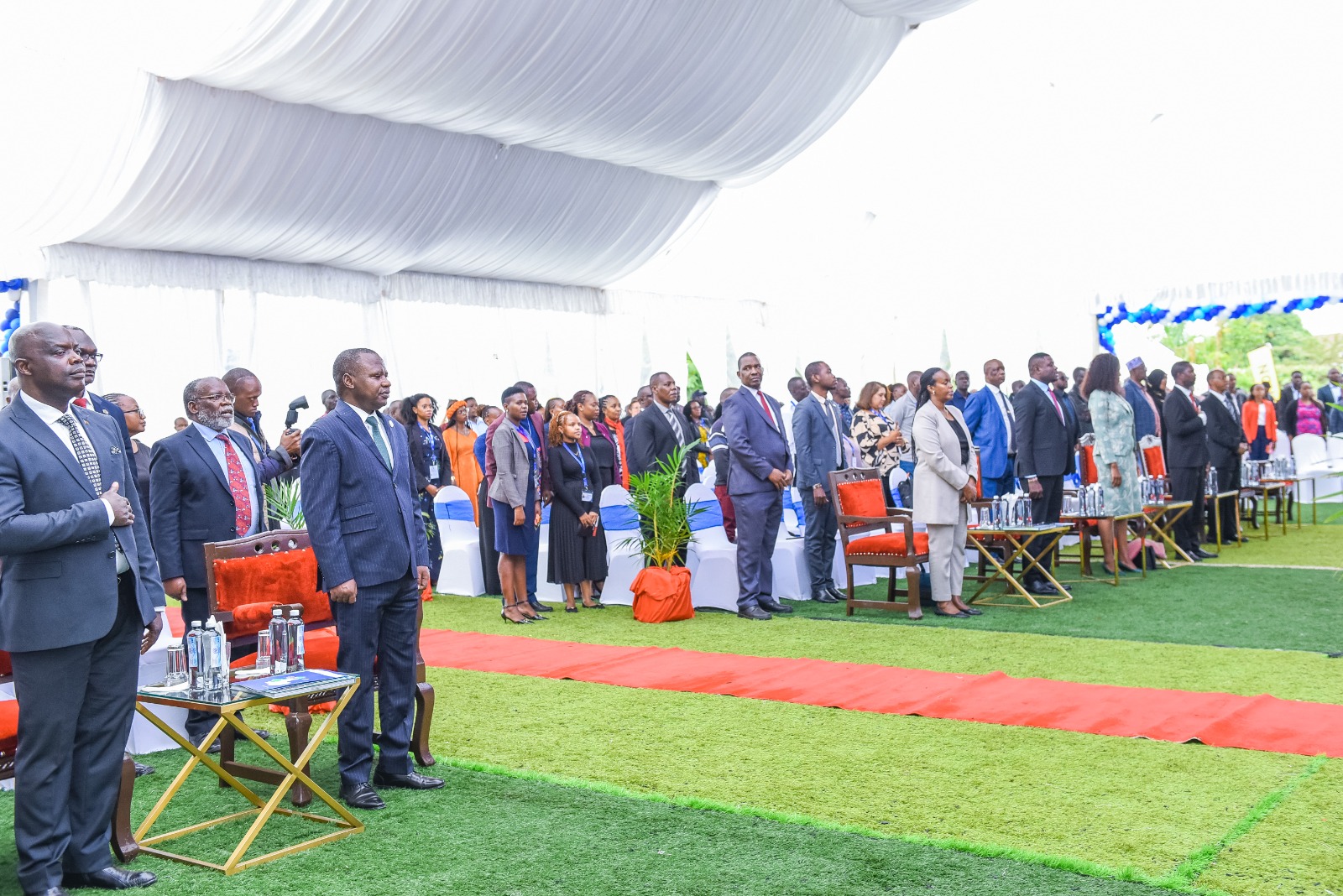
RCMRD Celebrates 50 Years of Excellence in Geospatial Innovation and Regional Development
A Legacy of Growth and Innovation
RCMRD began as a UN-supported initiative. Over time, it evolved into a fully-fledged intergovernmental organization.
It has consistently adapted to meet Africa’s changing development needs. Its work spans key areas such as remote sensing, GIS, land management, and environmental monitoring.
Today, RCMRD supports critical sectors including agriculture, climate action, land governance, and disaster preparedness.
Empowering Africa Through Training and Technology
Over the last five decades, RCMRD has trained tens of thousands of professionals. These include government officers, scientists, students, and development partners.
The launch of the Regional Centre for Training and Innovation (RCTI) expanded this capacity. Located in Nairobi, the modern facility hosts certified courses and workshops.
As a result, many African nations now have skilled experts using geospatial tools to solve local challenges.
RCMRD Governing Council Hon. Patrick Mucheleka Called for continued investment in human capital, encouraging member states to upscale training and GIS education through the RCTI centre.
He commended RCMRD’s five decades of service and emphasized its evolving mandate from mapping and surveying to leading data-driven decision-making across Eastern and Southern Africa describing it as “a pillar of regional collaboration in geospatial excellence.”
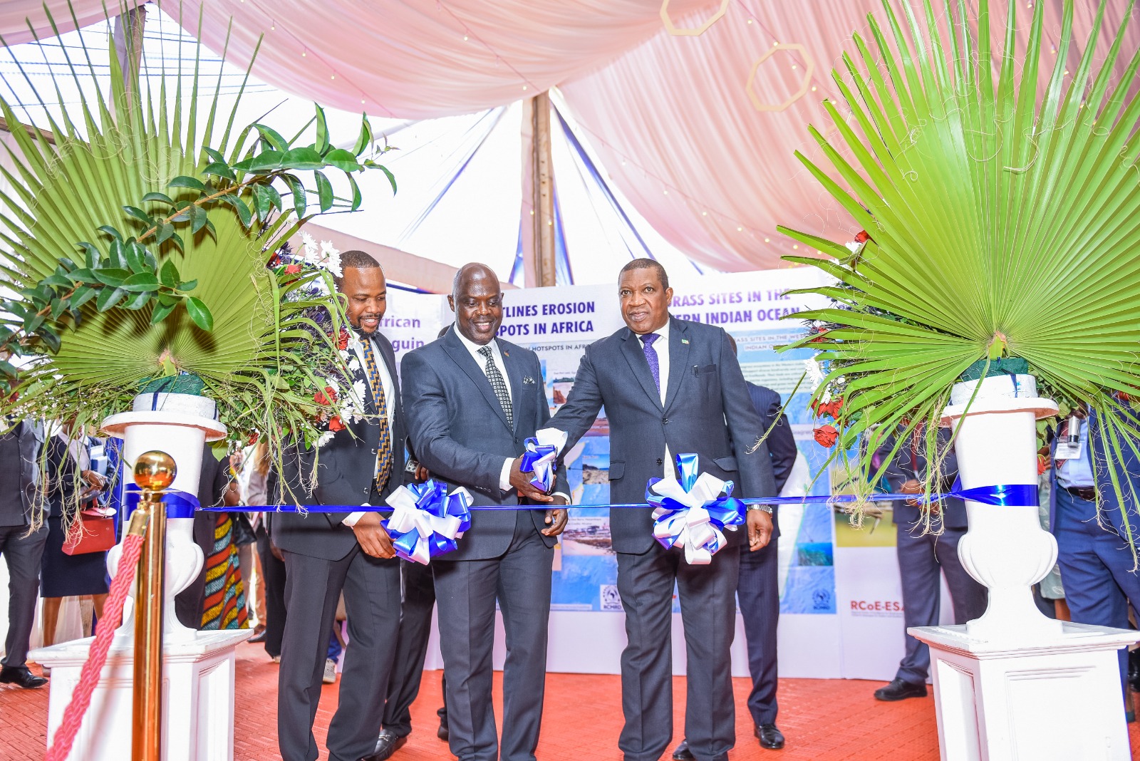
From left-PS Nixon Korir, Center Minister of Lands #Malawi -Hon. Deus Gumba , extreme right-RCMRD Governing Council Chair, also the PS, Ministry of Lands and Natural Resources, Zambia Hon. Patrick Mucheleka
Driving Sustainability Through Data
RCMRD has developed several digital tools to support sustainable development. For instance, the RCMRD Geoportal offers open access to spatial and environmental data. This helps in planning, monitoring, and informed decision-making.
In addition, mobile applications like LandPKS and tools like the Rangelands Decision Support Tool have improved land and resource management.
They are already helping governments and communities respond to drought, erosion, and land degradation. Furthermore, the African Agriculture Adaptation Atlas (AAAA) supports climate-smart agriculture in over 30 Kenyan counties.
Regional Partnerships and Global Recognition
RCMRD has built strong partnerships over the years. It works closely with African governments, universities, and global institutions like NASA, USAID, and the African Union. These collaborations have made the Centre a leader in data sharing, environmental monitoring, and technology transfer.
Moreover, the annual RCMRD International Conference (RIC) has become a key platform. It brings together experts and decision-makers to share solutions on climate, agriculture, and innovation.
Ministry of Lands & Natural Resources PS, Hon. Nixon Korir, reaffirmed the Ministry’s support for RCMRD, pledging to “deepen collaboration to preserve, protect, and plan for a land‑secure Africa”
He recognized the Ministry’s role in backing national-level adoption of RCMRD’s tools for land management and climate resilience.
Inclusion, Innovation, and Impact
RCMRD is also committed to inclusion and empowerment. In recent years, it has launched youth initiatives such as mapping competitions and hackathons. These programs encourage young people to apply geospatial tools in solving real problems.
At the same time, the Centre is advancing gender inclusion. Through the Women in GMES & Africa network, it is creating opportunities for women to lead in Earth observation and technology. Additionally, RCMRD supports county governments with community-level data that improves service delivery and livelihoods.
Looking Ahead: A Bold Vision for Africa’s Future
According to RCMRD Director General, Dr. Emmanuel Nkurunziza , RCMRD’S 50-year milestone is not just a celebration of the past. It is also a call to shape the future.
The Centre aims to expand its digital platforms, promote open data, and strengthen disaster risk reduction. It is also aligning its work with the African Union’s Agenda 2063.
Importantly, RCMRD is nurturing the next generation of African scientists and leaders. “The next chapter will be even more transformative. We are committed to using data to drive Africa’s development.” He noted











Comments